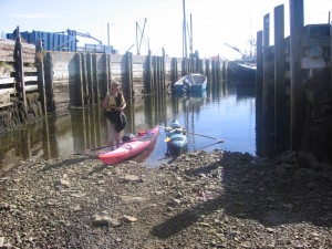
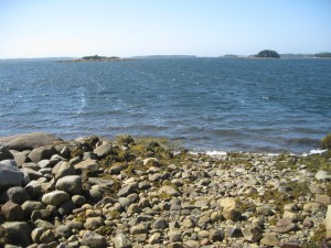
 Location: Bear Point Wharf
Shoreline: rocky
Type of access: paved road
Parking: yes
Government wharf: yes
Public slipway: yes
Topographic reference: 20 p/5 (Cape Sable Island)
Marine chart # 4241 (Lockeport- Cape Sable)
UTM grid: E0285154 Â N4818085
Latitude: N 43° 29.204’/Longitude :W 65° 39.403′
Â
Â
 Location: Harbour Road
Shoreline: rocky
Location: Harbour Road
Shoreline: rockyType of access: gravel road Parking: yes Remains of old public slipway Topographic reference: 20 p/5 (Cape Sable Island) Marine chart # 4241 (Lockeport-Cape Sable ) UTM grid: E0283908 Â N4818830 Latitude: N 430 29.574’/Longitude: W 65040.291′ Â
This access is useable if desired, there may be some outboard boats pulled up here.
Paddling from Bear Point towards the East or West makes for a very interesting paddle, there are numerous islands to explore or stay overnight on. Enjoy the quiet bays and inlets that are a nature lovers paradise.  A perfect place to catch a breathtaking sunset along the coast.
