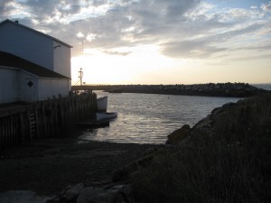
 Location: Abbott’s Harbour Wharf
Shoreline: beach stone
Type of access: paved road
Parking: yes
Government wharf: yes
Public slipway: no
Public concrete ramp: yes
Topographic reference: 20p/12 (Pubnico)
Marine chart # 4244 (Wedgeport and vicinity)
UTM grid: E0272545 Â N4838250
Latitude: N 43° 39.832’/Longitude: W 65° 49.404′
http://museum.gov.ns.ca/av/en/home/default.aspx
Â
For paddling information while in the Pubnico area contact:Â ken.dentremont@hotmail.ca
Â
Kayakers wanting to avoid going around the tip of West Pubnico, especially in unfavorable weather conditions can usually get one of the local fishermen to shuttle them from one wharf to the other. Example: Dennis Point Wharf-Abbott’s Harbour Wharf or reverse.
