 Â
Location: mouth of Shelburne Harbour
Â
Location: mouth of Shelburne HarbourShoreline: rocky
Type of access: a good paddle route to the island from either Gunning Cove or Carleton Village
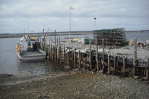
Government wharf: yes
Public slipway: yes
Topographic reference: 20p/11(Lockeport)Marine chart # 4241(Lockeport-Cape Sable)or #4209 (Lockeport and Shelburne Harbour)
UTM grid: E0314231 N4836063
Latitude : N 430 65611’/Longitude:W 650 30402′ from Government wharf. Â
http://www.novascotiaisland.blogspot.com/
McNutts Island or ‘Razoir’ as it was originally named by the French is another paddlers paradise located in the mouth of the Shelburne Harbour.
