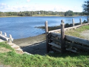
28. Rocco Point
Â
 Location: Rocco Point Wharf turn off #3 highway by the Catholic Church in Saint Anne du Ruisseau
Shoreline: gravel/rocky
Type of access: gravel road approximately 2 kil. off #3 highway
Parking: yes
 Gravel access
Topographic reference: 20 p/13 (Tusket)
Marine chart # 4244 (Wedgeport and vicinity)
UTM grid: E0264566 (64)Â Â N4855453 (55)
Latitude: 43° 48.995’ / Longitude: 65° 55.615
Name of owner: Richard Fieldman, paddlers have permission from owner to use as a launch site.
Rocco Point Nature Trail-The beginning of this trail is found at the first Chapel site in Rocco Point. The .5 km long nature trail overlooks the beautiful salt bay on one side and La Grande Pass on the other.
