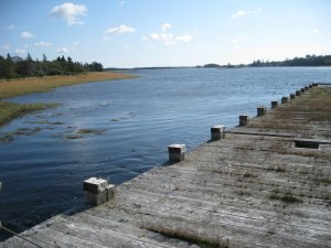
 Location: Eel Brook, next to bridge on highway
Shoreline:
Type of access: paved road
Parking: yes
Gravel shoreline for access
Topographic reference: 20 p/13 (Tusket )
Marine chart # 4244 (Wedgeport and vicinity)
UTM grid: E0264920Â (65)Â N4857453 (57)
Latitude: N 43° 50.103’ /Longitude: W 65° 55.388
Â
Public access
Easily accessible, just past bridge, good parking area, picnic tables. If the tide is right you can explore the coast down to Rocco Point and Salt Bay. Always check the local newspapers for the tide table. It can make a difference in your day!
