 Location: Dunhams Landing
Shoreline: gravel
Type of access: paved road
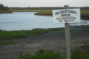
Parking: yes
Gravel access for launching
Topographic reference: 20-0/16 (Yarmouth)
Marine chart # 4243 (Tusket- Cape Saint Marys)
UTM grid: E0735519 Â N4854541
Latitude: N 43° 49.241′ / Longitude: W 066° 04.276′
Name of owner: Chebogue Recreational Area
Public Access
Kayaking information regarding Chebogue-Sandford area is available by contacting:Dan Earle: (902) 742-6382 or email: danearle@eastlink.ca
From Dunhams Landing on high tide you can paddle the Chebogue River out into Chebogue estuary, taking time to explore, have a picnic lunch or tent overnight at Crawleys Island. Chebogue estuary is home to many drumlins that were formed from glacier drifts. They now are handsome oval shaped hills or ridges.
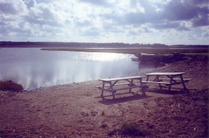
Dunhams Landing has picnic tables, so you can enjoy your lunch here before leaving to paddle and explore the Chebogue River. If you plan to return the same day, watch the tide cycle and return on the rising tide.
