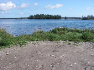
 Location: Ashton Mackay Road.
Shoreline: mixture of rock and gravel
Type of access: gravel road to shore less than 1 kil. from pavement
Parking: limited parking at launch site
Government wharf: no
Public slipway: remains of old wooden slipway nearby
Public concrete ramp: no
Topographic reference: 20p/11(Lockeport)
Marine chart: #4241 (Lockeport-Cape Sable)
UTM grid: E0325457 Â N4843441
Latitude: N 43° 43.515’/Longitude: W 65° 09.979′
Sugar Loaf and Douglas Island located just off the coast from this access.
This launch site lets you explore around West Green Harbour and surrounding islands.The government wharf is a short paddle up into the harbour and is well protected from the wind.
