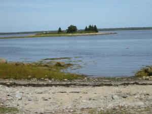
 Location: Sherose Island Nature Trail (located next to Barrington Arena)
Shoreline: gravel and rock
Type of access: gravel road from arena
Parking: yes, at launch site
Gravel access
Topographic reference: 20p12(Pubnico)
Marine chart # 4241 (Lockeport-Cape Sable)
UTM grid: Â N4823494
Latitude: N 43° 32.201’/Longitude: W 65° 35.561
Public access
The Municipality has given permission to paddlers to use this as a stop over place to tent if paddling through the area. The arena is within walking distance of the access if tenting here and there are washrooms and showers available to use. At the canteen you can get hot and  cold drinks, snacks and hot food off the grill.
This is an excellent place to stop and walk the Nature Trail after paddling and exploring the  beautiful Barrington Bay.
Visit our web site: Â www.barringtonmunicipality.com
