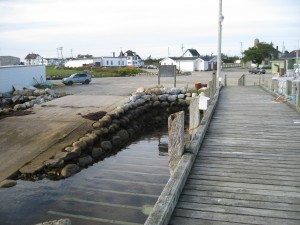
53. Clark’s Harbour
 Location: Water Street
Shoreline: rocky
Type of access: paved road
Parking: yes
Government wharf: yes
Public concrete ramp: yes
Topographic reference: 20 p/5 (Cape Sable Island)
Marine chart # 4241 (Lockeport-Cape Sable)
UTM grid: E0286843 Â N4813403
Latitude: N 43° 26.707′ Longitude: W 65° 38.006′
Just a short walk from the wharf is a grocery store,bank and Shell Garage.
The Town of Clarks Harbour has many interesting places to visit all within walking distance from the wharf.
