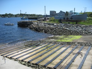
 Location: North Water Street in Town
Shoreline: sand beaches and rocky
Type of access: paved road and gravel to public wharf
Parking: yes
Government wharf: yes
Public slipway: yes
Public concrete ramp: yes
Topographic reference: 20p/11(Lockeport)
Marine chart #:4209 (Lockeport and Shelburne Harbour)
UTM grid: E0329744 Â N4840752
Latitude: 43° 42.139′ N/Longitude: 65° 06.744′ W
Â
 Landmarks visible from the water are breakwater, Carters Lighthouse and trawl bait sheds.
March 2025 M T W T F S S 1 2 3 4 5 6 7 8 9 10 11 12 13 14 15 16 17 18 19 20 21 22 23 24 25 26 27 28 29 30 31 -
Recent Posts
Archives
Categories
