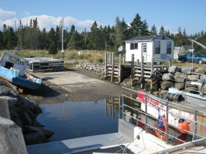
 Location: Jones Harbour Wharf
Shoreline: beach rock
Type of access: 14 kils of gravel road from turn off at Sable River/Port L’Herbert Road, 1 kils down Jones Harbour road to wharf.
Parking: yes
Government wharf: yes
Public slipway: no
Public concrete ramp: yes
Topographic reference: 20 p/15 and 20 p/10 (combined) Port Mouton
Marine chart #: 4240 Liverpool- Lockeport
UTM grid: E0331040 Â N4843144
Latitude; 43° 45.022′ N/Longitude: 64° 58.560’W
Â
Jones Harbour is nestled in a deep cove, well protected by Hardings Island, the wharf is located in a secluded area. Like most wharfs there are most always fishermen tending their boats that will give you helpful information.
